About
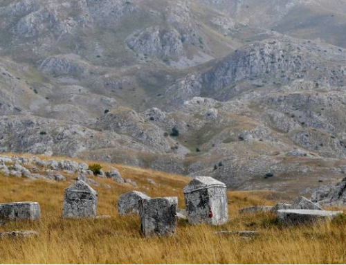
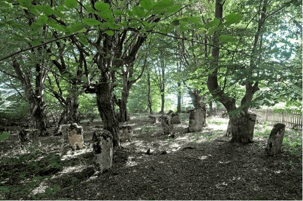
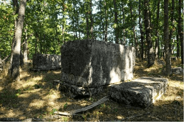
At the site of Ravanjska vrata, there is the Upper and the Lower necropolis (Gornja and Donja nekropola). The necropolises are located in the vicinity of the village of Mušići, about 15 km south of Kupres. The monuments at the Lower necropolis are finely carved and laid mostly in the northwest-southeast direction, while at the Upper necropolis they are oriented in both directions, west-east and north-south.
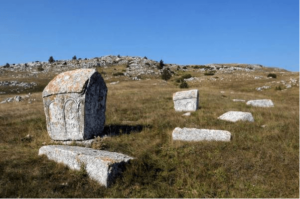
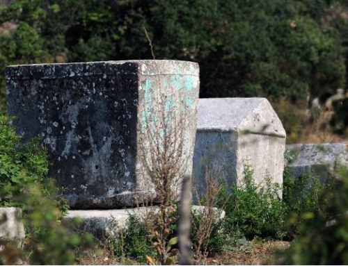
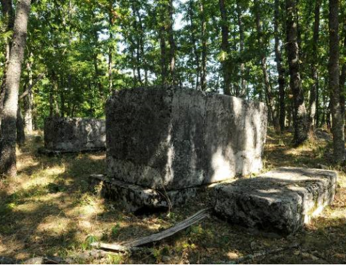
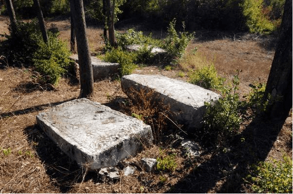
The Lower necropolis counts 43 stećci: 20 slabs, 20 chests and 3 gabled roof tombstones. Eighteen of them are decorated: 5 slabs, 10 chests and 3 gabled roof tombstones. The motifs include: bands and trimmings with slanting zigzag lines, vegetal stylizations including lilies, hunting and wheel dance scenes, hand with sword, shield with sword, two women, a man with a horse, bent vines with trefoils and twisted circular wreath.
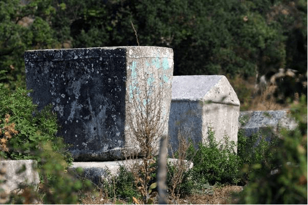
The Upper necropolis counts 25 stećci: 10 slabs, 8 chests and 7 gabled roof tombstones. Fifteen of them are decorated of which 5 slabs, 5 chests and 5 three gabled roof tombstones. The most numerous decorative motifs are rosettes, crescents, circular wreaths and crosses, but the tournaments in arcades and stylized lilies stand out by quality of workmanship. There are also bent vines with trefoils, a hand, a shield with a sword, staff, trimmings with plain and zigzag bands, a deer motif and a scene of two human figures in arcades.
No inscriptions were recorded.
Due to the harsh climate, this region is unsuitable for permanent human habitation. However, the material remains in various places throughout the Kupres plateau represent very convincing evidence that the area had been inhabited since the prehistoric period to the present day. The most numerous are prehistoric objects: the forts at Pogana Glavica, Velika and Mala Gradina in Vrili, the fort at Crljena, in Ravno, stone tumulus at Jeljan and at Dvorišća, earthen tumuli at Kupreško polje and around fifty groups with over a thousand tombstones. The most famous archaeological finding in the area of Kupres originates from the earthen tumulus from Pustopolje near Gornji Malovan, dated around 1800 BC.
Among the antique remains at the Kupres plateau, traces of Roman roads well-preserved in a considerable length are interesting. There is a famous Roman road in this area called Solarski put (Solari road) linking the Janja valley with the Rama valley. In Roman times, this road had undoubtedly a transversal role as to the Tomislavgrad – Bugojno main road. The section of the road from Vaganj to Varvara-Rumboka is still in use, although it does not follow the old route all the way, and departs from it at some places even by dozens of meters. Today, the abandoned part of the Roman road north of Gornji Malovan may be well traced. During the construction of the Bugojno-Livno road in 1892, the buried remains of a Roman house that had been used as a watchtower at Velika Vrata were found. In addition to the bricks, money, fibula, a stylus and a ring were found.
It is said that in 1447 the Bosnian diocese sent a plea to the Pope to bestow forgiveness for the church of the Holy Trinity in Vrli, i.e. Otinovci.
The medieval trade route that linked Split with the Vrbas River valley and passed through Kupres had a similar direction to the current and the Roman route (Stražanj-Malovan-Kupreško polje – Kupres – Velika Vrata). Venetian diplomat Katarin Zeno mentioned Kupres as castle Cuprus in his 1550 travelogue. In the Ottoman period, Kupres was a fortified town with three towers. According to H. Kreševljaković, Kupres was a small settlement which had emerged in mid-17th century; it was fortified in the 18th century and deserted in 1840.
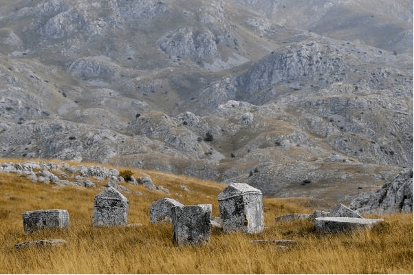
The area of high fields (Kupreško, Rilićko, Vukovsko and Ravanjsko polje), with over 40 necropolises, several detached monuments and registered 1055 stećci is a representative and best-researched area of western Bosnia. The Kupres necropolises are usually located near former Roman and medieval roads, on earthen burial mounds and tumuli.
Location
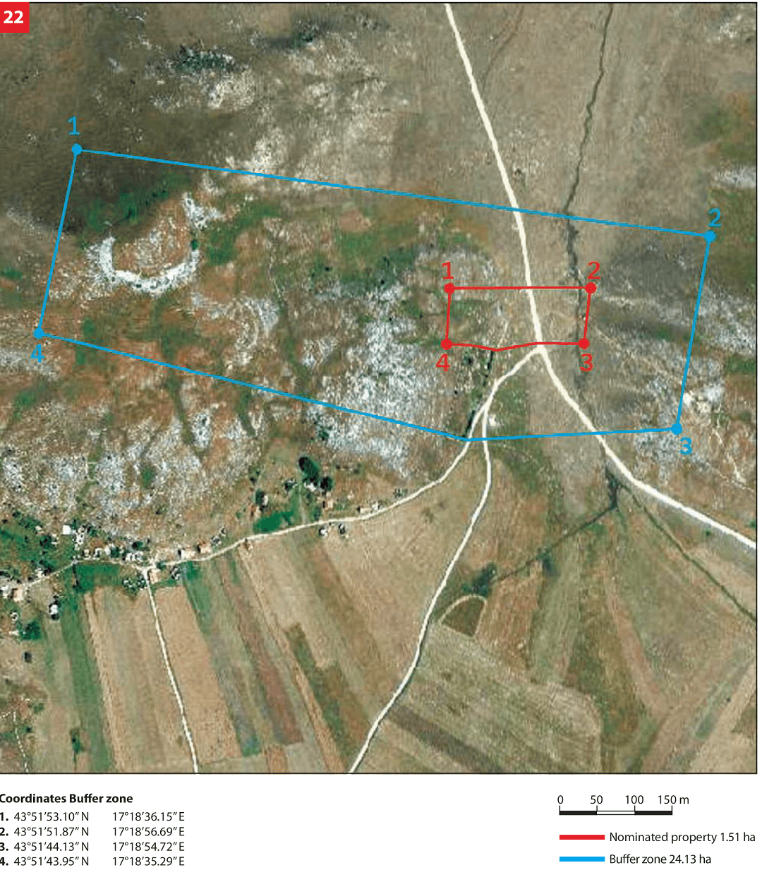
The necropolis with stećci is situated at the Ravanjska vrata site – a passage about 100 meters wide, between the hills of Gradac (end of Ravašnica) and Gradina connecting the fields of Vukovsko polje and Ravanjsko polje. The necropolis is cut across by a macadam road.

State of the location
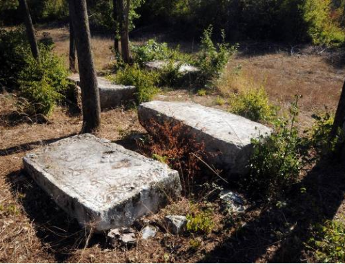
The condition of the site is not satisfactory. Sinking and movement i.e. tumbling of a large number of tombstones was recorded, and it cannot be precisely determined whether the stećci are in their original position. A number of the stećci are tumbled. The stećci are in a poor condition, largely covered by plant organisms (moss and lichen), most of which destroy their structure, and therefore a large number of decorations are no longer visible (preserved). Due to the effect of lichen and moss, several of the stećci are almost amorphous (the structure was destroyed by plant organisms). A number of the stećci have been visibly damaged (shallow or deeper cracks on the stećci, upper sides of the stećci were damaged). In 2011 the entire site underwent geodetic survey supported with photographs of individual stećci thus enabling for implementation of a monitoring process.
FAQ
The necropolis is located far away from the populated areas and in the vicinity of a passage cutting through the site. It is exposed to external influences and weather conditions. There is no security service and financial resources for maintenance are lacking. The level of activities on raising awareness about the significance of cultural and historical heritage in schools, kindergartens and among tourists is insufficient.
It is estimated that about 100 residents live in the nearby villages of Ravno and Mušić. There are no plans or programmes for the protection of sites with stećci at local level. The Spatial Plan of the Municipality of Kupres as well as the Master Plan for Tourism Development of the Municipality of Kupres state that it is necessary to carry out protection and revitalization of cultural, historic and natural heritage (page 22 and page 181 respectively).
The 2012-2017 Local Environmental Action Plan of the Municipality of Kupres specifies a set of goals and measures aimed at the protection of natural, cultural and historical heritage ( pages 32 –35) a portion of which is related to the stećci. The existing plans pertain to the municipality and region in which the nominated site is located. The spatial planning documentation includes: 2003–2023 Spatial Plan of the Municipality of Kupres; 2009 Master Plan for Tourism Development in the Municipality of Kupres; 2010 Programme of Agricultural Land Management in the Municipality of Kupres; 2012–2017 Local Environmental Action Plan of the Municipality of Kupres. The only offer for the time being includes tours and visits to the site, with no other services provided, while access is possible by an unpaved road running through the site. There is no visitor management plan, and there is a need to train tourist guides. The site is included in the brochures on economic opportunities of the Municipality of Kupres as well as in the LEAP brochure. A replica of the stećak from Ravanjska vrata is placed in front of the National Museum in Sarajevo. Some local websites have included information about the stećci in their contents. The realized number of overnights was 5,000.