About
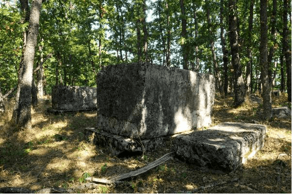
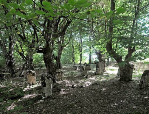
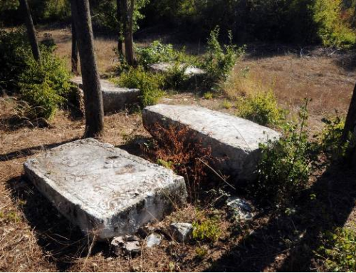
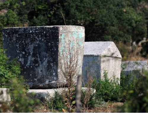
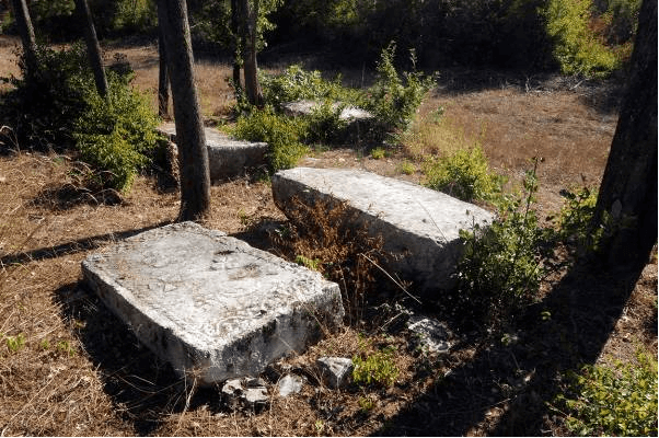
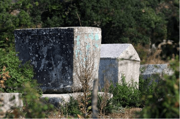
The necropolis is located in the north-western part of the Municipality of Rogatica, above the village of Burati, near the mediaeval Dubrovnik – Srebrenica road. A larger number of tombstones are oriented east-west, and a smaller number north-south. According to the data available to the Commission to Preserve National Monuments, a total of 212 tombstones have been recorded at the necropolis: 136 slabs, 67 chests, 7 gabled roof tombstones, 1 hollowed stone with trough, and 1 tombstone of indeterminate shape.
According to the data obtained following research carried out by the Institute for Protection of Cultural, Historical and Natural Heritage of Republika Srpska /Republički zavod za zaštitu kulturno istorijskog i prirodnog naslijeđa RS/ in 2012, 213 tombstones were recorded of which 61 chest, 14 chests with bases, 101 plate, 18 plates with bases: 15 fragments, 2 gabled roof tombstones and 1 gabled roof tombstone with base. 5 tombstones are decorated: 1 slab, 2 chests and 2 gabled roof tombstones. Decorative motifs include a double spiral, half-sphere, a cross, a crescent moon, a rosette, a lily, a hand with a sword, and a hunting scene of a hunter on foot with a spear, a dog, a deer and a bear.
No inscriptions have been recorded.
The oldest findings pointing to the signs of life in the Municipality of Rogatica date back to the period B.C. when the area had been inhabited by the Illyrian tribe of Autariatae. The monuments of material culture from the prehistoric period in the Rogatica area are forts and grave mounds. The Illyrian civilization was followed by the antique one created by Roman conquest of these territories. There is not enough data to elucidate the political, social and economic conditions of the region throughout the Middle Ages. This gap can be largely reconstructed with the help of material culture. There was a settlement In Rogatica in the Middle Ages, as may be concluded from two important facts: the old medieval route from Dubrovnik to Srebrenica, passing precisely through Rogatica, and substructures of the fortification still existing in the vicinity of the town.
The above Dubrovnik route was very travelled over several centuries. According to the documents from the Dubrovnik Archives, Rogatica was known in the 14th and 15th century as the centre of a rich cattle-breeding area from where Dubrovnik imported cattle. In the 14th and 15th century, Rogatica was closely connected to another town, the fort of Borač, and its rulers Radinovićes and Pavlovićes, who in the 15th century ruled over the whole area from the spring of the Bosna River to the Drina River, including the square in Rogatica. During the first years of the Turkish rule, the Rogatica square was called Borač (Bazaar Borač) after this town. Podrinje (the Drina River basin) was divided into the estates of two aristocratic families, the Pavlovićes and the Kosačas. In parallel with the rise and strengthening of these families, their forts were multiplying and grouping around the Drina River or its tributaries. There were never any archaeological excavations of the site. However, the importance of the site lies in the fact there are several other necropolises with tombstones in the vicinity of the site.
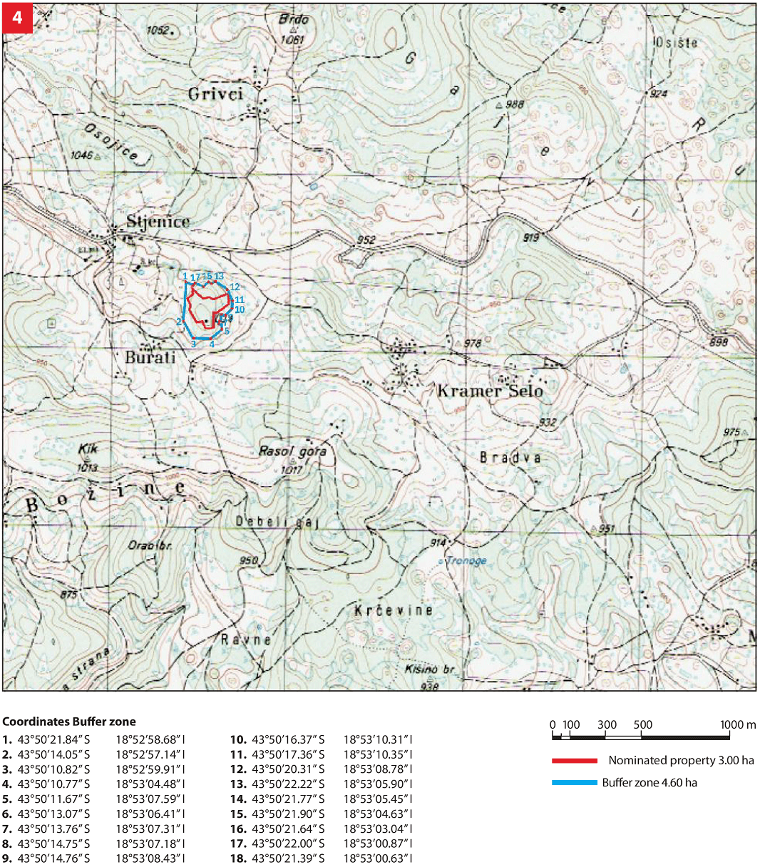
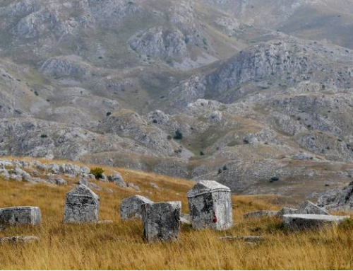
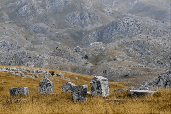
The necropolis with tombstones is located on a parcel situated on the hill Borak, near the village of Burati, south-east of the Sokolac – Rogatica road. The foot of Borak hill represents the border of the protected area. The national monument is located in an area that includes cadastral parcels 2125, 2171, 2172, 2173, 2175, 2176, 2208 of Kramer selo /Kramer village/, Municipality of Rogatica, Republika Srpska; private ownership – several persons.
Location
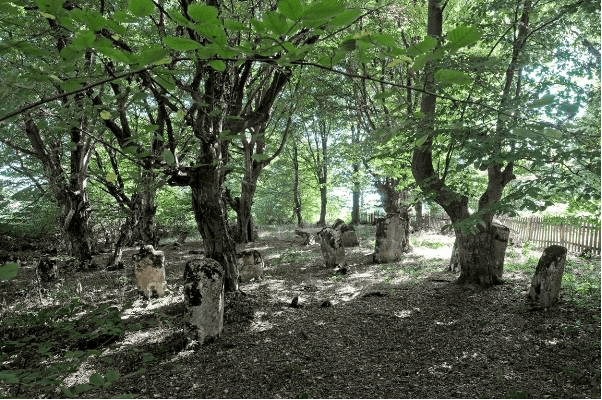
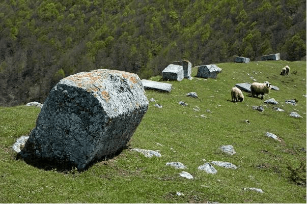
The necropolis with tombstones is located on a plot comprising the high grounds of Borak near the village of Burati, southeast of the main Sokolac – Rogatica road. The necropolis is located in a dense oak forest. The protected area borders with the base of Borak hill.

State of the location
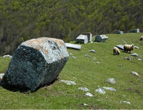
The site is in satisfactory condition. The necropolis is in its original state. The majority of tombstones are covered by plant organisms, mostly lichen and moss, some of which destroy the stone structure, and by leaves (the tombstones are found in a young oak-tree forest). It is impossible to determine the dimensions of the majority of tombstones, as they are partially or entirely sunken and densely covered by moss. Holes probably dug by wild animals were observed beneath a large number of tombstones, which additionally endangers the tombstones.
In 2011 the entire site underwent geodetic survey supported with photographs of individual tombstones thus enabling for implementation of a monitoring process.
FAQ
The necropolis is situated outside residential areas. The offer currently available to the visitors does not meet standard requirements, i.e. apart from the opportunity to see the site itself, there is nothing else they could do. The municipal area is characterized by other forms of tourism – hunting, adventure and religious. The most significant resources are the horse farm in Borike and the famous Bridge on the Žepa. The necropolis is marked with basic signs. At the necropolis site there is an info board of the Commission to Preserve National Monuments. Statistical data on the number of visitors are not available. In the Municipality there is a tourist organisation (www.rogaticaturizam.info)