About
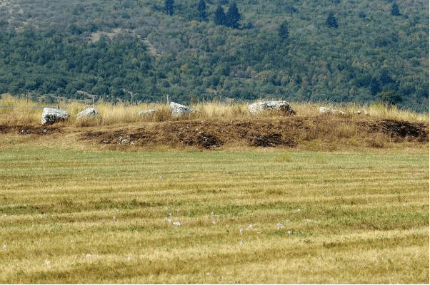
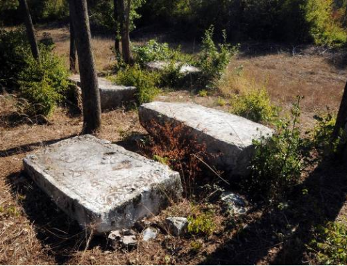
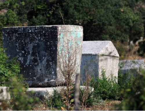
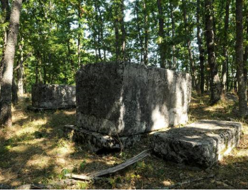
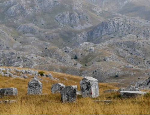
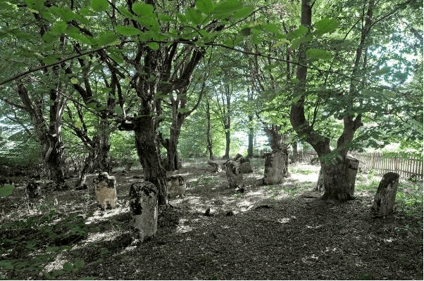
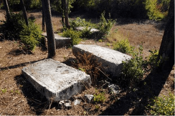
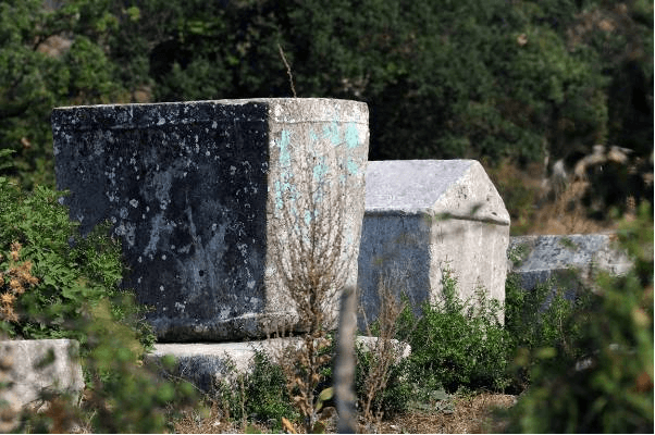
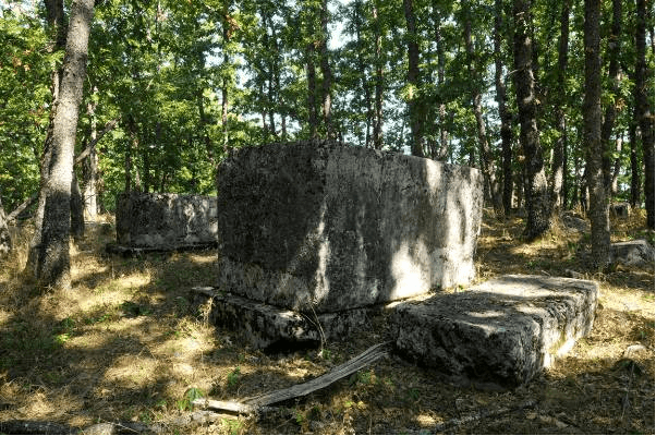
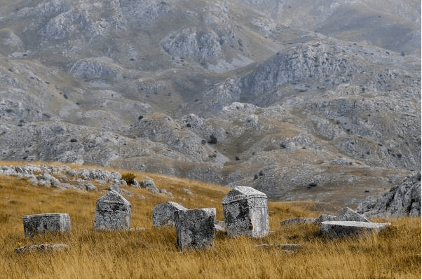
The two necropolises with tombstones are located 280 meters beeline apart, in the village of Košutica, about 6 km north-east of Sokolac, in the open spaces of the Luburića polje. The necropolis at the locality of Ploče is on a prehistoric tumulus of a 40 meters radius. In the center of the tumulus, there is a hollow square, which may be assumed to have been the place of a medieval building. The tumulus is about 3 meters high, and its volume is about 90 meters. It consists of 51 tombstones: 50 chests and 1 gabled roof tombstone. Three chests are decorated.
The necropolis at Bare is located on an elevated terrain which does not have a circular foundation. The elevation is 80 meters long and around 30 meters wide. Tombstones are oriented north-south. It consists of 83 tombstones: (78 chests, 1 gabled roof monument and 4 fragments of tombstones). Six chests are decorated.
According to the data obtained following research carried out by the Institute for Protection of Cultural, Historical and Natural Heritage of Republika Srpska /Republički zavod za zaštitu kulturno istorijskog i prirodnog naslijeđa RS/ in 2012, a total of 132 tombstones were recorded, of which 37 chests, 42 slabs, 1 gabled roof tombstones and 53 fragments.
Decorative motifs include a line denoting a double grave, a rosette, a sword and a cross.
No inscriptions have been recorded.
The settling of the area of Glasinačko polje (Glasinac field) started in the prehistoric period and has lasted to this day given that Glasinac represented the intersection of important roads which throughout history have been connecting the valleys of the Bosna and the Drina Rivers. Over 50 prehistoric forts and more than 1200 tumuli, concentrated in groups, have been recorded so far in Glasinačko polje. The oldest finds date back to the Illyrian tribe Autariatae, which, according to archaeologists and modern historians, lived in south-eastern Bosnia, south-western Serbia and northern Montenegro, or in the territory where an extremely significant group from the late Iron Age was identified, named Glasinačka. That group reached its peak from mid-7th to mid-5th century BC, judging by the settlements, graves and a large number of movable items, weapons, pottery, jewelry, bronze imported crockery, etc.
A large number of medieval necropolises with tombstones have been registered in the area, which was built on burial mounds or next to them. It proves that the area was largely populated at that time and that there was historical continuity of burials. In addition to the necropolis with tombstones in Luburića polje, there are necropolises on the sites of Talin, Laze, Kusače, Čavorine and Potpećine.
A large number of tumuli were investigated and the oldest ones date back to the early Bronze period. Archaeological explorations have been conducted at the forts of Kusača, Košutica, Kadić brdo, Iliak and Loznik.
During the Middle Ages, those areas were part of the county Mokro-Glasinac, which included Glasinačka ravan from the old county of Olovo and the county of Pale from the basin of the Paljanska Miljacka River. Those counties and the neighboring Prača belonged to the Pavlović land.
During the period of Ottoman rule, more precisely in the 15th and 16th century, the area was in the vilayet Pavle, and in nahiya (administrative unit) of Olovo. At the end of the 16th century, a new kadiluk (sub-division of Ottoman Empire – territory of judge or kadi) Birač (Vlasenica), including Knežina with the surrounding area, was established.
Numerous necropolises with “Nišan” tombstones have been preserved from that period. In the 20th century, a road was built next to the necropolis, which divided Luburića polje into two parts.
This whole area was explored already at the end of the 19th century. Investigation of the forts and tumuli in the area were conducted in 1886-1891. Research continued throughout the 20th century.
Location
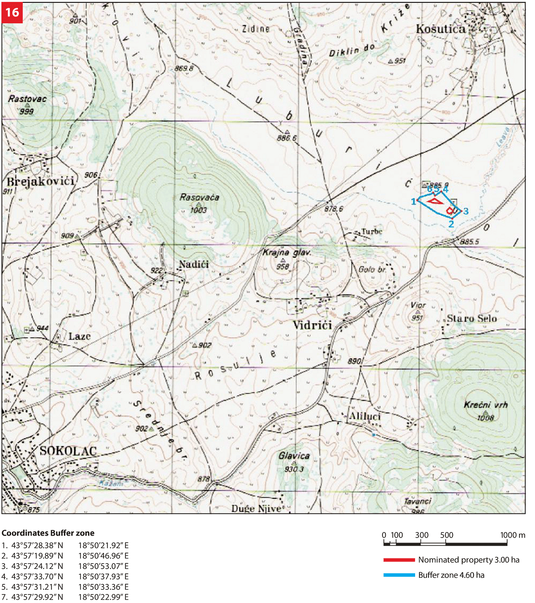
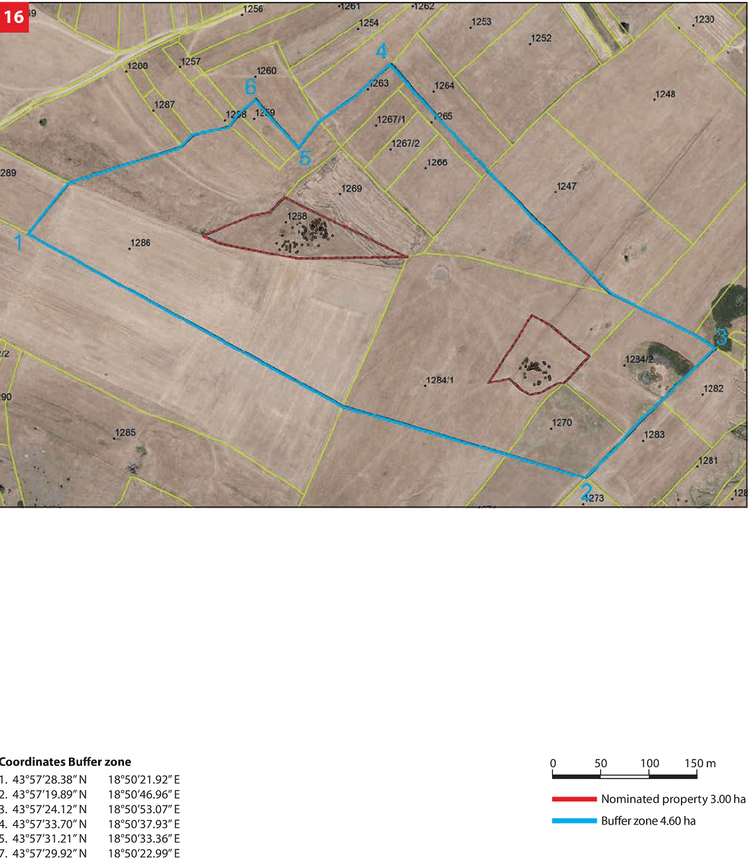
Tombstones are located in two necropolises with prehistoric tumuli near the village of Košutica in the vast area of Luburića polje. The plots with tumuli and tombstones are about 150 meters beeline apart. The boundaries are defined by a fence.
State of the locations
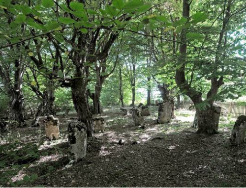
The site is in satisfactory condition. The necropolis is in its original state. Most of the tombstones are covered by plant organisms, mostly moss and lichen, some of which destroy the stone structure. A substantial number of the tombstones have been damaged due to long-term impact of environmental factors.
Many of the tombstones are cracked and sunken, which is why they cannot be examined in their entirety. In 2011 the entire site underwent geodetic survey supported with photographs of individual tombstones thus enabling for implementation of a monitoring process.
FAQ
The current tourist offer for visitors does not meet the standard requirements, i.e. apart from sightseeing there is nothing else available. The majority of visitors are tourists in transit, although the region has the capacity for rural and hunting tourism development. There are no data on visits to the site.
The necropolis with the tombstones is located outside the populated area. There is a macadam access road. The necropolis is marked by basic tourist signs. Statistical data on the number of visitors are not available. Municipal tourist resources are related to rural tourism, religious facilities and archaeological sites (Glasinačko polje). There is a Tourist Organisation operating in the Municipality.