About

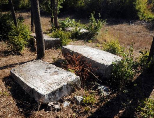
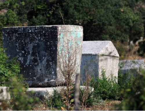
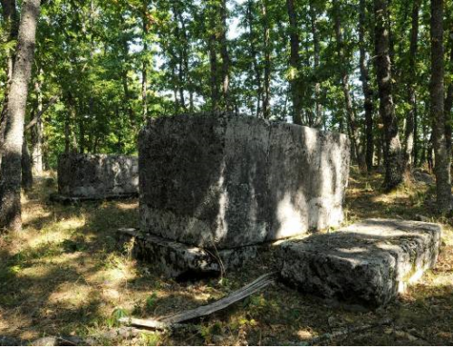
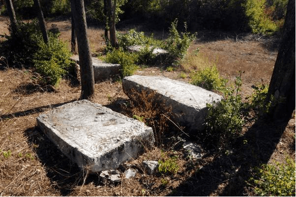
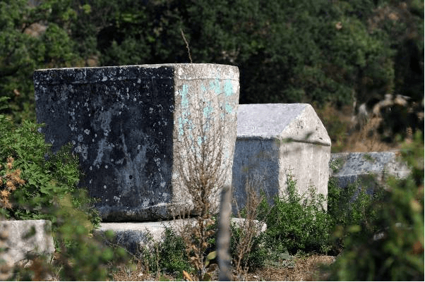
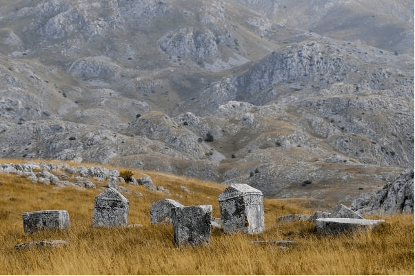
The necropolis is in the village of Baljci at the Radmilovića Dubrava site, about 4 km to the northeast of Bileća. The Drežnica quarry is located approximately 2 km beeline from the necropolis to the northeast, where tombstones had been cut and carved. According to the data available to the Commission for Preservation of National Monuments, based on research carried out by Šefik Bešlagić, a prehistoric tumulus and a necropolis with 291 tombstones are found at the locality: 218 slabs, 64 chests, 1 gabled roof monument, 1 pillar, 1 monumental cross, 1 nišan and 5 sunken tombstones, the shape of which could not be determined.
According to the data obtained following research carried out by the Institute for Protection of Cultural, Historical and Natural Heritage of Republika Srpska /Republički zavod za zaštitu kulturno istorijskog i prirodnog naslijeđa RS/ in 2012, a total of 321 stećak was recorded, of which 74 chests, 19 chests with bases, 211 slabs, 1 slab with base, 1 gabled roof stećak, 1 gabled roof stećak with base, 1 pillar, 1 tombstone with monumental cross and 10 fragments.
They lie west-east and north-south and they are well hewed.
Thirty-two are decorated: 4 slabs, 26 chests, 1 monumental cross, and 1 gabled roof stećak. The motifs are arcades, scrolling vines with trefoils, crosses, rows of rosettes and circular wreaths, networks of rhombi, twisted garlands, a “vodenica” (circular garland) and a hand.
The literature mentions 7 epitaphs inscribed on 2 slabs, 4 chests and 1 gabled roof tombstone. The epitaphs referred to Vukša Dubčević, Bunco Rušović, Rašoje, Crijep and Raško Vlahović, Vitoje Daković, the monk Gligorije and Rado Raičev. Today, only two chests bear visible inscriptions.
The first traces of human culture and civilization in the Municipality of Bileća date from the New Stone Age (Neolithic), as evidenced by archaeological sites still insufficiently explored.
The administrative and economic centre of the area during the period of the Roman Empire was located in the village of Panik, in the Trebišnjica River valley, known in literature as Leusinium. Across the Trebišnjica River, close to Leusinium, there was a bridge with a preserved inscription indicating that the bridge had been rebuilt during the reign of the Flavians from 79 to 84, which also represented the first written source in the Municipality.
The first reference to Bileća as a town may be found in the Dubrovnik archive documents from 1286, under the name Bilechia. In the same source and under the same name, Bileća was also mentioned in the 14th century as an important crossroad of medieval caravan routes. In the immediate vicinity of Bileća, there are remains of the medieval fortified town of Torič, which had reportedly belonged to the family Pavlovićes in the 15th century. Bileća fell under the Ottoman rule in 1466.
The necropolis with tombstones Grebnice was built on prehistoric tumulus, which marked the continuity of burials in the area. Archaeological research has not been conducted.
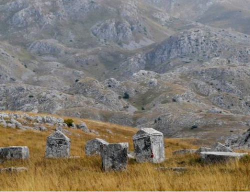
In addition to this necropolis dating from the 13th and 16th century, there are others that have been preserved. Thus, over 1,700 tombstones have been registered up to date.
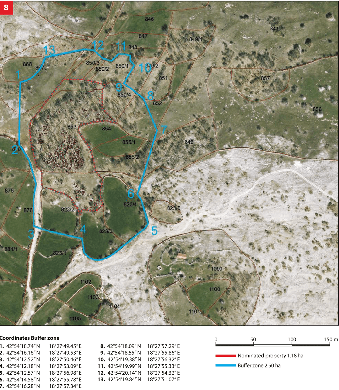
The site of Grebnice, Radmilovića Dubrava is located in the village of Baljci, about 4 km beeline to the north-west of Bileća. The national monument is located in an area designated as cadastral parcels 422/3, 422/10, 422/10, 422/11 cadastral municipality of Baljci, Municipality of Bileća, Republika Srpska, Bosnia and Herzegovina; state ownership.
Location
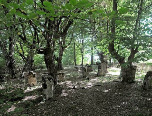
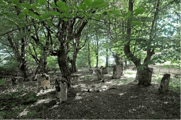
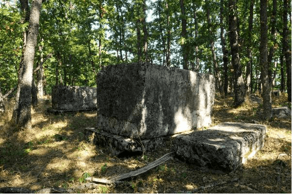
The site with the prehistoric tumulus and the necropolis with tombstones is located near the village of Baljci at the junction of Radmilovića Dubrava at the Grebnice site. The parcel with the necropolis is located in an oak forest.

State of the location
The site is in satisfactory condition. Some tombstones are chipped, damaged, tumbled, partially or entirely sunken. The tombstones are, to a greater or lesser extent, covered by plant organisms (moss and lichen). Part of the tombstones is covered by low vegetation and sunken, which is why they cannot be examined in their entirety. In 2011 the entire site underwent geodetic survey supported with photographs of individual tombstones thus enabling for implementation of a monitoring process.
FAQ
Facilities for visitors and infrastructure:
The access to the necropolis with tombstones is possible by a macadam road built by local residents. The necropolis is marked by basic tourist signs. Statistics concerning the number of visitors are not available. Municipality tourist resources are related to nature – Bilećko lake, religious facilities, archaeological sites, ancient towns and fortifications from the period of Austro-Hungarian rule. A Tourist Board is active in the Municipality area.